

Mount Alto [Cnoc Ruairi]
Good walks are even better shared.
Overview
Mount Alto [Cnoc Ruairi]
Introduction
Nestled in the picturesque Southern Uplands, Mount Alto, known locally as Cnoc Ruairi, stands at an inviting height of 539 meters. Though it may not be the highest decree in Scotland, it certainly offers a charming jaunt through nature with stunning views and a touch of historical intrigue.
Geology
The mountain predominantly features Old Red Sandstone, which gives it a unique reddish hue. As you climb, keep your eyes peeled for the occasional volcanic rock outcrop hinting at the geological complexities of this ancient region.
The Route
The most popular route starts at Dalmellington. The Cnoc Ruairi Route is moderate, making it accessible for those in reasonable shape. This 8 km trek takes roughly 3.5 hours, allowing you to take in the sights—and catch your breath at the summit!
Summit Features
Upon reaching the summit, you’ll be greeted by a sturdy cairn and some delightful stone markers. These serve as perfect backdrops for your treasured summit selfies. Don’t be surprised if passing sheep stare you down in envy!
Terrain
Expect grassy slopes with occasional rocky patches. The ascent isn’t without its surprises—some boggy areas may try to test your balance and your footwear. Remember, every puddle is just another chance to make a splash!
Views
From the summit, sweeping views greet hikers. Look out for the rolling hills and distant peaks of the Midlands. Late spring and early autumn are the best times for clear visibility and delightful hiking conditions.
Hazards
Stay alert for sudden weather changes, a hallmark of the Southern Uplands. Additionally, tread carefully around boggy patches and be wary of sheep who may want to assert territorial rights over your graze!
Nearby Summits
If you’re feeling adventurous, consider tackling nearby peaks like Green Hill and Benbrack. They’re not too far away and will allow you to collect some extra views for your hiking album.
Access
Dalmellington provides a convenient jumping-off point. A small car park is available for those who prefer to drive, while public transport options exist for the more communal traveler. The village café offers a great stopping point, complete with essential facilities.
Conclusion
Whether you're seeking solitude, adventure, or simply a good story to tell, Mount Alto [Cnoc Ruairi] is more than just a hill. It’s an invitation to explore, discover, and maybe—just maybe—contemplate life over a cup of the café’s finest brew after a day of conquering peaks!
Finish
So grab your walking boots and make the short drive, or hop on a bus! Mount Alto awaits.
Explore routes near Mount Alto [Cnoc Ruairi]
Public walks starting within 80 km of this hill. Nearby does not mean a route reaches the summit; check its map and access before setting out.
No public routes are currently listed within 80 km of Mount Alto [Cnoc Ruairi] on Walkmates. This does not mean there are no paths here. Explore the map and check local access information before planning a walk.
Route planning notes
These notes describe possible approaches, not verified navigable routes or permission to cross land. Check current paths, local access rules and conditions before setting out.
Cnoc Ruairi Route
A scenic ascent starting from the village of Dalmellington, weaving through ancient woodlands and open moorland.
Make a day of it, together
Find someone to share the walk with, or organise a day out along a route you like.
Photo Gallery
View all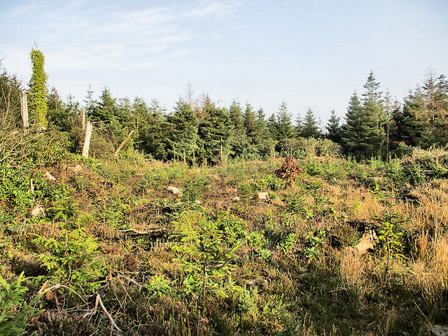 Photo could not load
S6335 : Young Forest
kevin higgins
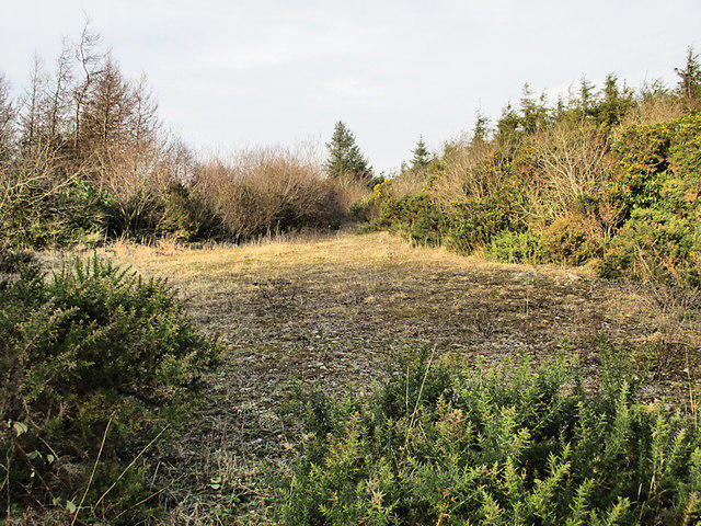 Photo could not load
S6335 : Open Space
kevin higgins
Hill facts and local notes
Classifications
Elevation
276m
906 ft
Prominence
147m
Coordinates
52.4642, -7.0738
S630351
OS Map
68 76
At the Summit
The summit features a prominent cairn and an old stone marker, offering a perfect spot for a photo opportunity, or a place to catch your breath (and possibly your lunch).
Terrain & Geology
The mountain's structure is primarily composed of Old Red Sandstone, giving it a reddish hue. Occasional outcrops of volcanic rock may also be found, offering a glimpse into the geological past of the region.
Views & Scenery
From the summit, you can see the rolling hills of the Southern Uplands and, on a clear day, the distant peaks of the Midlands. Look north for a view of the interestingly shaped hills that dominate this charming landscape.
History & Heritage
Name Origin
Cnoc Ruairi translates to 'Ruairi's Hill' – a fitting homage, though the identity of Ruairi seems to have slipped through the mists of time.
Historical Significance
Historically, the Southern Uplands played a vital role in the Highland Clearances, a chapter worth delving into for those interested in the region's rich and complex history.
Getting There & Facilities
Check current local access restrictions, parking rules and transport timetables before travelling. These notes do not confirm public access to the summit.
Parking
There is a small car park near the village of Dalmellington, providing ample room for hikers. Just mind the occasional game of chicken with the local sheep!
Public Transport
Regular bus services operate from Ayr to Dalmellington, though check the latest timetables for a suitable match with your hiking schedule.
Nearby Facilities
Nearby facilities include a lovely café in Dalmellington serving hot drinks and snacks. Toilets are available at the café, a crucial pit stop before starting your adventure up the hill!
Safety Information
Known Hazards
- Beware of sudden weather changes, as conditions can shift rapidly in the Southern Uplands. Also watch for boggy ground and the occasional sheep with opinions on your choice of hiking boots.
General Safety Tips
- Check weather conditions before setting out
- Carry appropriate clothing and equipment
- Let someone know your planned route
- Take a map, compass, and GPS device
- Carry emergency supplies: food, water, first aid kit, torch
Hills
Some common questions about the hills answered
Are there group walks up Mount Alto [Cnoc Ruairi]?
Many walkers use Walkmates to join or organise walks with others. You can check for group walks around Mount Alto [Cnoc Ruairi] through the maps
Are there other walkers around Mount Alto [Cnoc Ruairi]?
Activity varies by location and time, but Walkmates lets you see whether others have shared walks or shown interest in this area. Find other people through the walking friends search walking friends for Mount Alto [Cnoc Ruairi] search or of course create your own walk for Mount Alto [Cnoc Ruairi]
Can I organise a walk to Mount Alto [Cnoc Ruairi]?
Yes. If there aren’t any walks listed already, you can create a walk and make it available for others to join.
If you're signed up to Walkmates, you can create a walk to Mount Alto [Cnoc Ruairi].
How do I find a walk up this hill?
There are often multiple ways to walk this hill, depending on experience and route preference. Walkmates helps you explore walks and routes that others have shared.
Can I suggest a new route up Mount Alto [Cnoc Ruairi]?
Yes. You can suggest or create routes to share with others. Walkmates focuses on the social side of walking, so routes are used to help people organise walks and explore areas together, rather than as detailed navigation tools or route libraries.
Other uses really appreciate knowledgeable walkers sharing their routes. Share your favourite route to Mount Alto [Cnoc Ruairi] here
The is an error or something incorrect about this hill. How do I let you know?
We always strive to keep the information on Walkmates as accurate as possible. If you find an error, please let us know through the contact form and we'll aim to correct it as quickly as possible
Community Discussion
Comments
Location
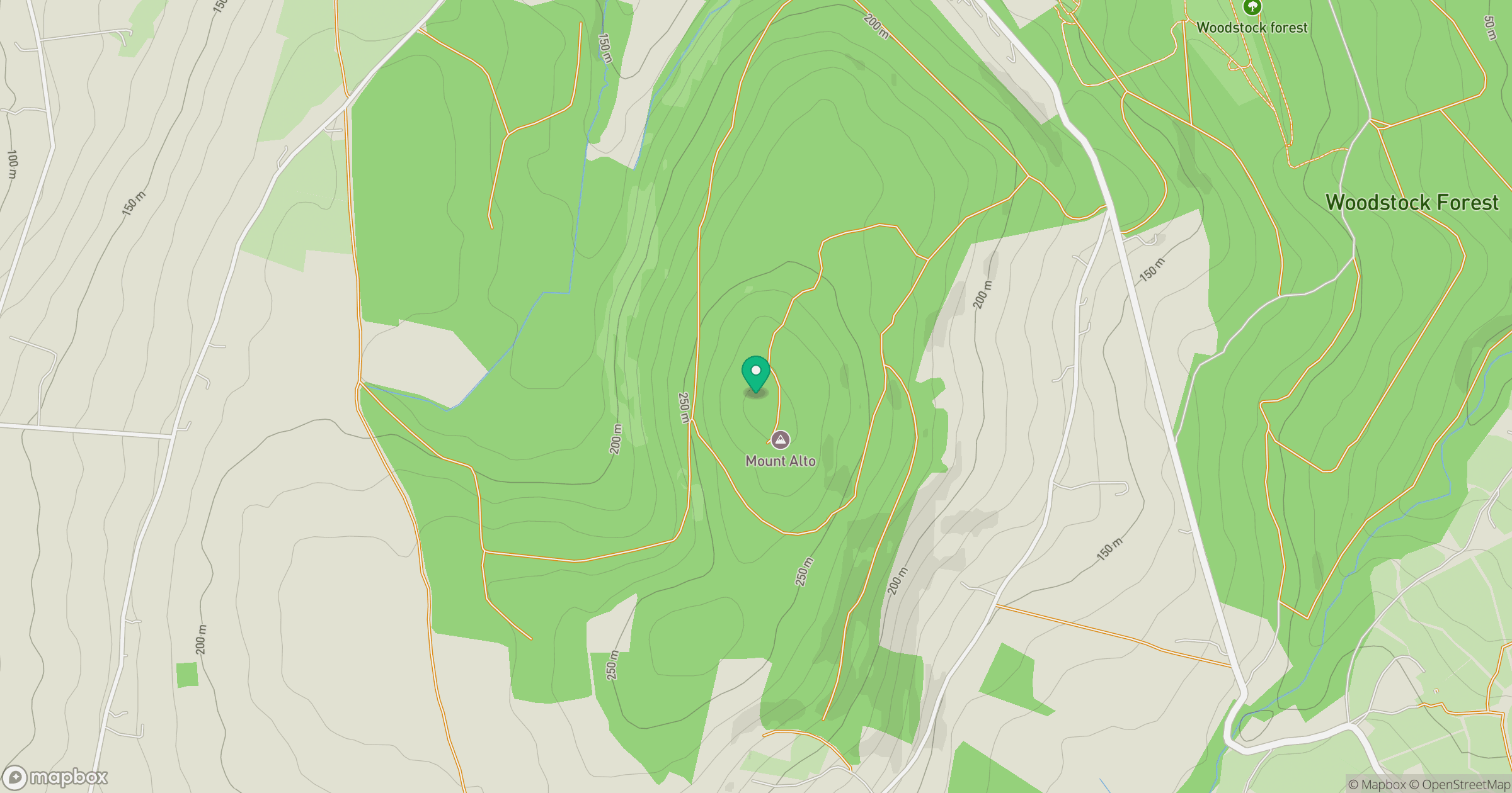
Grid reference: S630351
View on OpenStreetMapOpens a map in a new tab, centred on the hill.
Hills within 30 km
Straight-line distance, not a walking route or confirmation of access.
No comments yet. Be the first.